


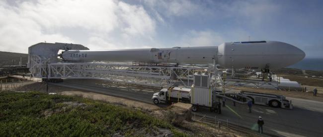
NASA to launch Jason-3 Ocean-Monitoring Satellite
"Liftoff aboard a SpaceX Falcon 9 rocket from Vandenberg’s Space Launch Complex 4 East is targeted for 10:42:18 a.m. PST (1:42:18 p.m. EST) at the opening of a 30-second launch window. If needed, a backup launch opportunity is available on Monday, Jan. 18 at 10:31:04 a.m. PST (1:31:04 p.m. EST)," the NASA said in a statement.
Jason-3 will add to a 23-year satellite record of global sea surface heights, a measurement with scientific, commercial and practical applications related to climate change, currents and weather.
Jason-3 data will be used for monitoring global sea level rise, researching human impacts on oceans, aiding prediction of hurricane intensity, and operational marine navigation.
The mission is planned to last at least three years, with a goal of five years. It is a four-agency international partnership of the National Oceanic and Atmospheric Administration (NOAA), NASA, the French Space Agency CNES (Centre National d’Etudes Spatiales), and EUMETSAT (the European Organization for the Exploitation of Meteorological Satellites).
Image: SapeceX
Support Our Journalism
We cannot do without you.. your contribution supports unbiased journalism
IBNS is not driven by any ism- not wokeism, not racism, not skewed secularism, not hyper right-wing or left liberal ideals, nor by any hardline religious beliefs or hyper nationalism. We want to serve you good old objective news, as they are. We do not judge or preach. We let people decide for themselves. We only try to present factual and well-sourced news.
Support objective journalism for a small contribution.